


By Lucky Kidd
Potentially dangerous winter weather conditions will spread across a large part of Kansas Monday into Monday night as the second in a series of disturbances moves into the central plains.
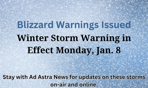
Blizzard warnings have been issued for west central and portions of central and southwest Kansas starting Monday afternoon. Winter storm warnings are up for much of northern Kansas and a small portion of central Kansas including the Great Bend and Salina areas. Winter weather advisories have been issued for much of the rest of Kansas except for counties along the Oklahoma border from the Medicine Lodge east that for the most part will begin this evening and extend into noon Tuesday.
For most of central Kansas, you can expect rain through much of the day Monday, mixing with snow at times with temperatures in this area currently expected to remain above freezing. The changeover to all snow will take place this afternoon for areas generally west of US 281, and by mid-evening along the I-135 corridor.
When the snow starts, it will be accompanied with a sharp increase in winds from the north. Most of central Kansas can expect wind gusts to around 50 miles an hour with higher gusts of 60 to 70 miles an hour expected roughly west and north of a line from Liberal to Larned to Hays These winds will cause blowing and drifting of snow, with whiteout conditions possible at times.
As this system moves out, there is another storm system that impacts the area later this week. While snowfall amounts are still uncertain this far out, what is certain is a polar air mass that will bring the coldest temperatures and wind chills of the season. By this weekend wind chill values could be well below zero and temperatures close to zero if not a little below, especially for northern areas.
Stay with Ad Astra News for updates on these storms on-air and online.