


Very heavy rain Monday night into early Tuesday morning produced another round of flooding and wind damage in parts of Central Kansas, with flooding along the Smoky Hill River in McPherson and Saline counties and Mulberry Creek near Salina. The heaviest rainfall fell over western Saline County into parts of northern McPherson County. Flash flood warnings were issued for parts of McPherson, Saline and Lincoln Counties due to the heavy rain.
The Heaviest rainfall reported in the area was 8.88 inches from a CoCoRaHS station 3 miles west southwest of Marquette, with 3-5 inch rainfall common over northern parts of McPherson County, with 1-3 inches common in the southern part of the county. Officially, McPherson Cooperative weather observer Jerry Bruce reported 3.77 inches, with 3.15 inches reported east of Lindsborg.
In Saline County over seven inches was reported in the Brookville area, with under an inch reported to the east of Salina. Nearly six inches was reported at Kanopolis Lake with 3 inch plus rainfall around Ellsworth and Little River, with over two inches at Lyons.
In Hutchinson 1.72 inches was reported on the northwest side of Hutchinson with two inches north of Hutchinson and on the southeast edge of Hutchinson while just .61 of an inch was logged at Hutchinson Regional Airport.
In Marion County the heaviest rain was from around Hillsboro to the Durham area with under an inch in the northern and eastern parts of the county. In Harvey County rainfall ranged from near two inches west of Hesston to just over a half inch south of Newton.
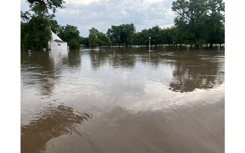
Considerable flooding was reported around the area… in McPherson the entirety of Lakeside Park was under water, with water also covering much of Lakeside Drive on both sides of the park north of Euclid and West Lakeside Drive south of Euclid.
The Smoky Hill River at Lindsborg is forecast to crest at 22.5 feet this afternoon, 1 ½ feet above flood stage, and go back below flood stage this evening. At Mentor the Smoky Hill will crest at 20.5 feet, just above flood stage early Wednesday morning. Mulberry Creek near Salina is forecast to crest at 25.5 feet this afternoon 1 ½ feet above flood stage and fall below flood stage this evening.
Marion County Emergency Management reported wind damage including several trees downed around the county, including a tree uprooted and laying across a road in Tampa and another tree fell onto a trailer in Hillsboro. Two semis were blown over along I-70 west of Salina. According to Emergency Management Director Marcy Hostetler, the downed trees led to a crash this morning on Kanza Road.
In Hillsboro, there were many branches and trees downed, along with a lightning strike at a gas station. There was also a hay bale struck in Goessel.