


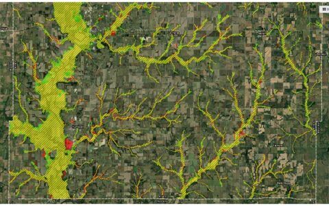
Appeal periods are now open with the Kansas Department of Agriculture’s Division of Water Resources on proposed floodplain maps for Allen and Neosho counties. The Allen County map was released for public review in November 2023 with the Neosho County Map released in August 2023.
Property owners and lessees now have one more opportunity to provide engineering data through their community as part of an appeal process which for Allen County runs through October 1st and for Neosho County October 16th.
The new maps will provide communities with up-to-date flood risk information and tools that can be used to enhance local mitigation plans, and help local officials and residents make informed decisions about reducing flood risks and purchasing flood insurance.
Both projects are part of a nationwide effort led by the Federal Emergency Management Agency to increase local knowledge of flood risks and to support actions to address and reduce those risks. This process involved local community officials in both counties.
Submitting an appeal requires the development of science-based data or technically backed information to replace or update preliminary engineering, which can require a significant investment of time and money. Those interested in submitting an appeal are recommended to first discuss it with their local floodplain administrator to help provide guidance on the process, as appeals must be submitted through your local floodplain administrator.
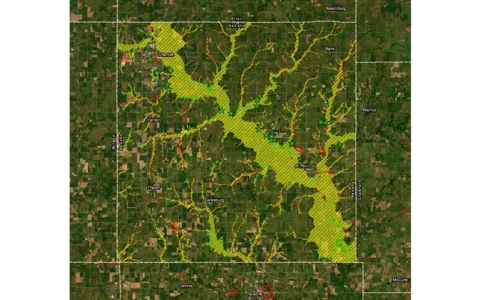
Appeal period guidance along with contact information for local floodplain administrators is available at the KDA–DWR website under the Lower Neosho Custom Watershed mapping project page. The new maps, which can be found on the KDA–DWR website, is still a preliminary version.
For contact information, to view the new maps, or to find out more about Kansas floodplain mapping projects, visit www.agriculture.ks.gov/floodplainmapping; select “Lower Neosho Custom” and then select the county in question.