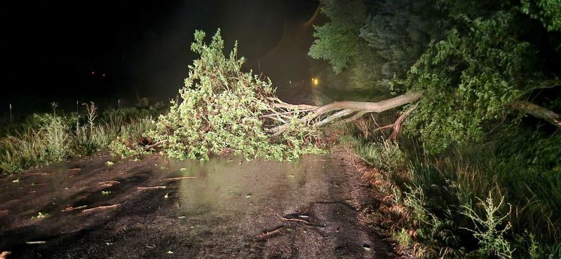


Wind gusts as high as 65 to 70 miles an hour brought damage across southeast Kansas Saturday night.
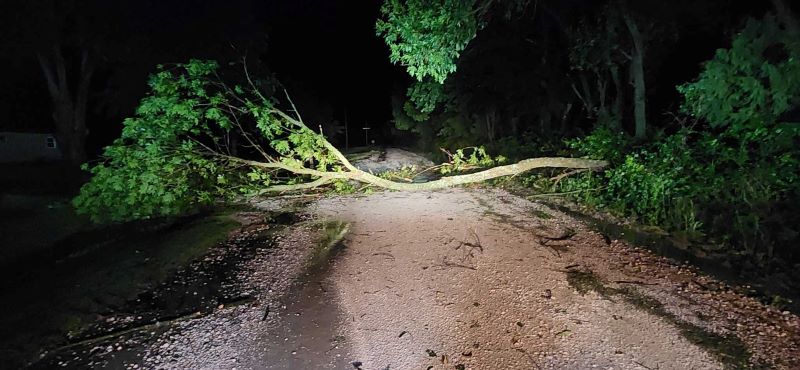
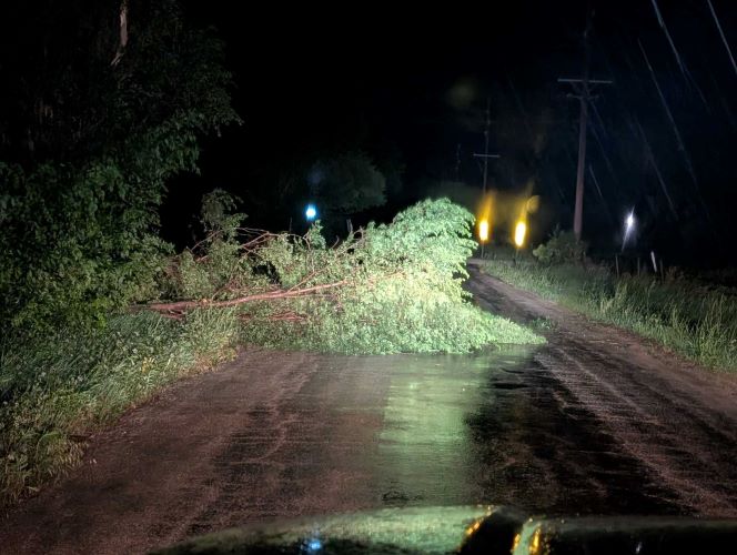
Allen County Emergency Management Director Jason Trego said there were a number of instances of trees downed along county roads to the south of Gas and La Harpe, in the Humboldt area, and west of Mildred. Some of the trees were able to be moved by law enforcement, other required public works assistance to clear roadways.
Trego said law enforcement near 1400 and Texas Roads near Carlyle and firemen responding to a lightning strike of a Utility Pole along US 54 between Iola and Gas encountered very heavy rainfall with zero visibility and strong winds. A tree was set on Fire by a downed line in Humboldt.
Woodson County Emergency Management Director John Akins IV reported late Saturday there were numerous reports of trees and power lines down in Yates Center and more out in the county, along with a storage shed-type portable building blowing over and sliding across the street. A number of power lines were also downed in Garnett, and large limbs were downed east of New Strawn.
As the storm moved through wind gusts were clocked at 66 miles an hour at Allen County Airport south of Iola and at Coffey County Airport north of Burlington. 58 mile an hour gusts reported at Martin Johnson Airport in Chanute.
Early Sunday afternoon Evergy has 149 customers without power in Neosho County, 24 in Coffey County, 69 in Linn County, and a few scattering in Allen, Anderson, Wilson and Woodson counties.
As of noon Sunday, 4 Rivers Electric has 95 customers still without power, mostly in Neosho, Wilson and Woodson Counties. Heartland Rural Electric Cooperative had a handful of customers off in Allen, Bourbon, Linn, Neosho and Wilson counties.
The storms also produced heavy rainfall. The heaviest report to the National Weather Service was 4.36 inches from a CoCoRAHS station at Erie. Other rainfall reports included:
2.45” near Yates Center
2.18” a mile west-northwest of Altoona
2.35” in Colony
2.11” east of Welda
2.02” east of Savonburg
2.00” north of Galesburg
1.64′ in Garnett
1.60” a mile east-southeast of Humboldt
1.55” north of Altoona
1.54” northeast of Neosho Falls
1.35” at Chanute Martin Johnson Airport
1.00” in Iola
Reports from CoCoRAHS observers, K-State Mesonet stations, and National Weather Service cooperative obsevers