


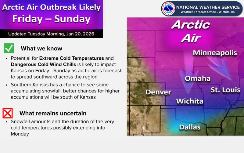
Extreme cold temperatures and dangerous wind chills will likely impact Kansas this weekend. The National Weather Service says an arctic air mass is forecast to move into the area Thursday night, with this air to stick around into next week.
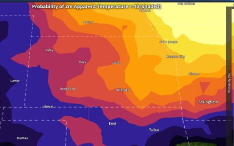
Current forecasts indicate overnight lows for Saturday and Sunday morning will be in the low single digits above and below zero, with wind chills forecast to be in the -10 to -20 range during this time. Daytime highs for Friday and Saturday will not get out of the teens.
There is also the potential for snow for Friday and Saturday. There is still considerable uncertainty as to how much snow will fall, if any. Current data indicates southern Kansas has the better chances for accumulating snowfall, with the heaviest snowfall currently expected to stay south of Kansas.
The major forecast models over the past few days have started to come into some consensus that there will be heavy snow some place, however forecasters have been pointing out a lot could change in the coming days. It could be another day or two before they have a better idea as to what this will look like locally. They generally agree any snow would fall Friday into Saturday evening.